The World Bank has yesterday removed erroneous maps of Morocco that mistakenly included the non-self-governing territory of Western Sahara.
See also: World Bank in discordance with the UN on Western Sahara.
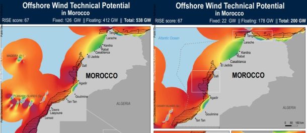
Western Sahara Resource Watch (WSRW) wrote on 27 May that the World Bank had posted information about Morocco's offshore wind potential, but including the territory of Western Sahara.
A part of the non-self-governing territory is under illegal Moroccan occupation.
The World Bank communicated to 28 May 2020 that "action is being taken to remove the map that includes Western Sahara" and that it will come back to WSRW with further response. Shortly after, the World Bank removed the incorrect portal and maps.
WSRW wrote the bank on 27 May, including the following questions:
1. Will the World Bank remove the abovementioned map that depicts Morocco as including Western Sahara, to make it aligned with UN cartography of the Kingdom of Morocco?
2. Will the World Bank remove the portal site on Morocco’s offshore wind potential that lumps Western Sahara in with Morocco?
3. What is the source of the statistical data included on the map that includes Western Sahara?
4. Has the statistical data on the offshore wind energy potential been shared with the United Nations, bearing a special responsibility for the Territory, as no administering power has been appointed to it?
5. Has the statistical data on the offshore wind energy potential been shared with the Polisario Front, recognised by the UN as the political representation of the people of Western Sahara?
6. Why has the World Bank opted to publish two different portal sites and maps, and not limited itself to only present information that is relevant to Morocco proper?
7. Can the World Bank guarantee that it will not invest in any projects in Western Sahara, nor facilitate such business, as long as the conflict has not been settled in line with international law?
World Bank in discordance with the UN on Western Sahara
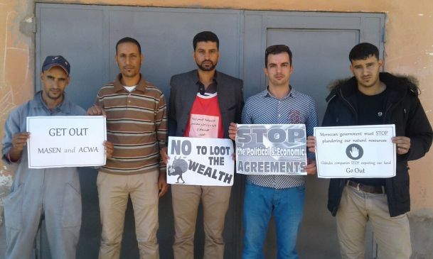
The World Bank seems to assist Morocco in promoting renewable energy projects in the occupied Western Sahara, as it fails to distinguish between the territory of Morocco and the Non-Self-Governing Territory.
Read also: World Bank removed erroneous maps
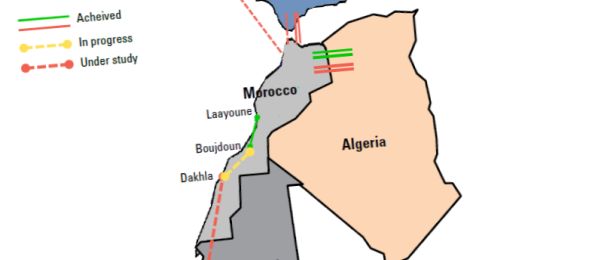
UN study on Morocco's green energy plans fails at geography
A case study on Morocco's policy reforms regarding renewable energy by a UN agency completely ignores the fact that a significant share of Morocco's planned production will come from occupied Western Sahara, as it fails to even distinguish between the two territories.
Vigeo Eiris goes back on false claim
Vigeo Eiris reports untruly about UN human rights approval
The company that certified energy infrastructure in occupied Western Sahara, claims that a UN body had found the company not to breach human rights.